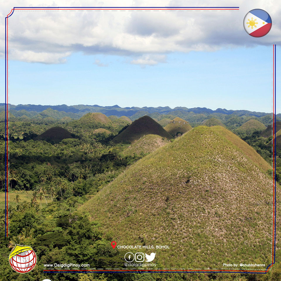
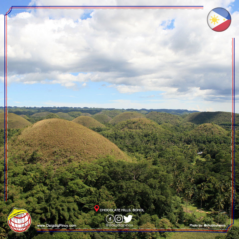
Your trip to Bohol will never be complete without taking a glimpse on the famous Chocolate Hills.
On your way to the Chocolate Hills, you will be welcomed with the beauty of Bohol’s Man Made Forest. Planted initially to prevent flash floods in the area and maintain ecological balance in the remaining natural forest, the man-made forest of Bilar is the largest man-made forest in the country. Thousands of mahogany seedlings were planted during the time of Governor Lino Chatto on a cleared area of 857.4 hectares in Bilar and Loboc towns. The tall Mahogany trees can be seen along the road as you travel to Chocolate Hills.
The story behind the formation of the chocolate hills? Well, about 2 million years ago, most of the island of Bohol was below a shallow sea. Coral reefs, similar to these found offshore of Northern Bohol, thrived and extremely covered the sea floor. During stormy days, fragments of coral reefs and shells derived by waves from the reef were deposited mostly by the landward side of the reefs. The coral and shell fragments formed relatively thin layers surrounding the live coral reefs.
Slowly, the land rose causing the coral reef formation to emerge out of the sea. The Southern section of Bohol had been uplifted more than the Northern section.
The chocolate hills had been carved out from the relatively thin layers of coral reef and shell fragments. During the initial stages, gullies were formed and developed in the low-laying areas and lakes occupied pre-existing depressions.
Coral and shell fragments are largely composed of calcium carbonate, a chemical compound that can be dissolved by acidic solution. Rainwater becomes slightly acidic by dissolving carbon dioxide from the atmosphere. Thus, rainwater can dissolve coral and shell fragments but this happens slowly. With rainwater acting on the thin layer of coral and shell fragments for tens to hundreds or thousands of years, gullies were deepend and widened to become streams and lakes were emptied by underground rivers and inter-connected hills were formed the original flat surface.
When the base of the soluble formation was reached, down cutting ceased and lateral erosion became dominant. Valleys were widened, remnants of the layers of the highly dissected areas were dissolved away and the connections between the neighboring hills were also dissolved away. The Chocolate Hills that you now behold are products of the patient laboring of rainwater on this soluble limestone formation.
There are 1,268 hills in 3 municipalities.
In recognition of its special characteristics, scientific importanct, uniqueness and high scenic value, the National committee of Geological Sciences declared the Chocolate Hills of Bohol a National Geological Monument, as of June 18, 1988.
There are 214 agonizing steps up to the designated viewing deck. It’s tiring but when you reach the top, it’s all worth it. People cram to have the best shot in the area. You have to wait for your turn to be able to take a good picture with the hills. Yes, patience is a virtue and you have to be quick too because people are also waiting for you to finish. So when you are positioned in the spot you think is best, take all the pictures you want as fast as you can. Don’t forget to smile!